📍 Quick Facts & Useful Info
🧭 Open in MapsLocation📍 Sardinia
Accommodations nearby🏡 10 Mare In holiday resorts starting from 3.6 km
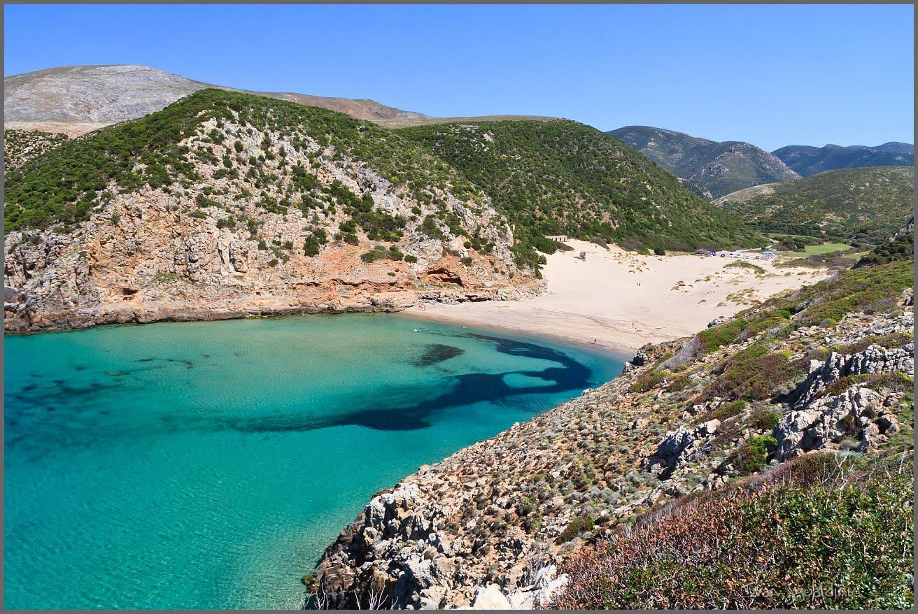
Cala Domestica Beach is located in the historic region of Iglesiente, within the municipality of Buggerru, along the southwestern coast of Sardinia. The inlet stretches out like a deep and picturesque natural fjord, nestled between tall white and golden limestone-dolomite cliffs—among the oldest rock formations in Italy, dating back over 500 million years — which shield it from crosswinds.
The main beach consists of fine golden and amber-colored sand, bordered behind by soft dunes covered with Mediterranean scrub and a small wetland area behind the dunes. The sea features crystal-clear waters with vivid hues ranging from emerald green to turquoise, and a sandy seabed that is shallow near the shore, making it ideal for children to swim. Along the rocky walls of the fjord, the seabed becomes deeper and teeming with fish, attracting enthusiasts of snorkeling, scuba diving, and sport fishing.
ℹ️ Services:
The beach is mostly unregulated to preserve its wild charm, but behind the dunes there is a large paid parking area during the summer months (with a designated area for RV parking), wooden walkways leading down to the beach, and a beach bar offering quick meals, drinks, and rentals of umbrellas and lounge chairs.
🚗 How to get there:
From Cagliari or Iglesias, take State Road 130 to Iglesias, then continue toward Gonnesa and Nebida/Masua by turning onto the scenic Provincial Road SP 83 toward Buggerru. About 2 km before descending toward the town of Buggerru (or about 6–8 km south of the town toward Masua), turn off and follow the road signs for Cala Domestica to the parking lot behind the dunes, from which you can reach the beach in a few minutes on foot along the boardwalk.
💡 Fun fact:
• Industrial mining archaeology: Until 1940, Cala Domestica Bay served as a strategic port of embarkation for lead and zinc ores extracted from the nearby mines of Acquaresi and Planu Sartu, which were loaded onto sailing barges bound for Carloforte. Even today, the striking ruins of the warehouses, hoppers, and loading tracks are clearly visible on the walls of the fjord; they are an integral part of the Sardinian Geomining Park and the Santa Barbara Mining Trail.
• The tunnel in the rock and “La Caletta”: On the right (northern) side of the beach is a pedestrian tunnel carved by miners into the limestone cliff to allow railway cars to pass through. Walking through this short tunnel carved into the rock leads you to a second, secluded and sheltered cove called La Caletta (or Cala Domestica Piccola)—a true natural pool nestled among the cliffs.
• The Spanish Tower on the promontory: At the tip of the southern headland that closes off the fjord stands the Cala Domestica Tower, approximately 10 meters high and built in 1779 to defend the coast and the tuna traps from Barbary pirate raids; it was later used as a lookout post during World War II. It can be reached via a scenic hiking trail that offers breathtaking views of the cliffs all the way to the Pan di Zucchero sea stack in Masua.
Photo: Panoramio
📍 Location Map
Geographic Location
Do you want to go on holiday near this wonderful beach? Fill out the form to receive our accommodation proposals.
📬 Request a quote
Enter your contact details to be reached back with no obligation.
🏷️
Best Price Guaranteedlower than other portals
🚢
Ferry discounts up to 30%included in your package
⚡
Free quote in 2 hourswith no obligation
🏡 Where to stay
Recommended Holiday Resorts

Residence Buggerru
📍about 3.6 km from here

Torre dei Corsari Vacation Rentals
📍about 34.5 km from here

Arborea - Horse Country Resort
📍about 48.9 km from here

Porto Pino Sant'Anna Arresi
📍about 48.9 km from here

Chia Vacation Rentals
📍about 67.5 km from here

Santa Margherita di Pula Vacation Rentals
📍about 67.9 km from here

Kala and Moru Vacation Rentals
📍about 88.8 km from here

Villasimius Residence
📍about 100.7 km from here

Villasimius Vacation Rentals
📍about 101.6 km from here

Bosa Marina, Oceanfront
📍about 102.0 km from here